


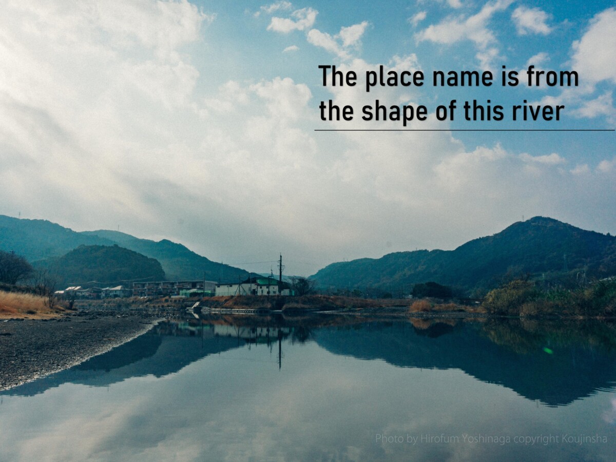
地名はこの川の形から
「水俣を知るには、地図の上で川の流れを追うこと」と誰かがいった。中医学に「経絡」という発想がある。「経絡」とは、気を運ぶ道筋だ。川は地域にとっての「経絡」なのだ。水俣は、その体の隅々まで豊かに「経絡」がはりめぐされている豊かな土地。だから、チッソは川の上流に発電所を、そして川下に工場をつくったのだ。
(By Minamata Impact)
Someone once said, “To understand Minamata, follow the flow of the river on a map”. In Chinese medicine, there is a concept called “meridians,” which refers to the pathways that carry qi. A river is a “meridian” for a region. Minamata is a rich land with many meridians running through every corner of its body. That is why Chisso built a power plant upstream and a factory downstream.
(By Minamata Impact)

以下、水俣市企画・監修「水俣堂々」より抜粋。
The following is an excerpt from “Minamata Dodo” planned and supervised by Minamata City.
並行からXに From Parallel to X
水俣の「俣」の字は「股」と同義だ。遠いむかし、村の中心部を二本の川が二股になって流れており、それが地名になったと伝えられている。はじめてその名が文字として登場するのは、平安時代の法令集・延喜式の全国交通路(陸路) の項だ。二本の川とはこうである。一本は現在の越小場あたりを源流とする水俣川と国見山や大関山を源流とする久木野川が合流して作る水俣川本流。もう一本は矢筈岳から発するいくつもの渓流を集めて走る湯出川。江戸中期まではこれら二本が並行して流れていた。江戸末期になるとこの二本が平野部(現市立総合体育館あたり)でX状に交差して流れ始めた。まさに「水の俣」の景色だ。
A long time ago, two rivers ran through the center of the village in a Y-shape. It was from this shape that the name of the village was derived. Until the mid-Edo era, the rivers ran parallel, but by the end of the Edo period, the rivers crossed in an X-shape in the plain area.
X からYへ from X to Y
X の形状で中州になった地区が堤防も低く、川の氾濫で被害を受けることが多かったため、県営事業として昭和7(1932) 年から同9( 1934) 年にかけて水俣川大改修工事を敢行した。水俣川本流と湯出川が合流する地点の小崎から海に抜ける新しい川の道を造り、X からY の字へと形を変えたのだ。
三方の山々から流れ下ってきた水が、最後はY になり一本に太く育って八代海へ注ぐことになるのだが、久木野から河口近くまで、水俣川と肩を並べるようにつづいている、不思議な運動場がある。その名も「日本一長〜い運動場」。
 Because the sandbank area in the middle of the rivers had a low levee, and the area flooded often, causing damage to the area around it, a prefectural project was implemented between 1932 and 1934 to create stronger and higher levees and reconfigure the X-shaped rivers into a Y-shape.
Water from the three mountains flow into each other to create a Y-shape, which then runs in one thick, straight line all the way down to the Yatsushiro Sea. Running parallel to the Minamata River, all the way from Kugino to the sea, is a strange athletic field—none other than “Japan’s Longest Athletic Field”.
関連記事一覧


コメント ( 0 )
トラックバックは利用できません。
この記事へのコメントはありません。